A map for the lesson, in one link.
Students open the link on any device with a web browser and see exactly the map you chose — the same place, date and layers. No installation, no student accounts.
A 50-minute lesson in five steps
Built on two examples, “Europe on 27 June 1914” and “Europe on 1 July 1920”. Any pair of examples works the same way.
Before class (5 min)
Open the first example on the classroom screen and check that it loads. Copy its link for the students.
Introduce (10 min)
Show Europe on 27 June 1914 and read the question under it together.
Explore in pairs (15 min)
Students open both examples on their own devices and list what changed between 1914 and 1920.
Discuss (15 min)
Collect the changes. Which empires lost land, and which states appeared?
Wrap up (5 min)
Each pair moves the clock (the button at the bottom right of the map) to a year of its choice and reports one change. The Share button turns their view into a link you can collect.
Nothing in this lesson needs an account. A teacher who signs in can also ask Atlas questions in words; Atlas has a daily limit per account.
Classroom tours
A tour is a short lesson already laid out: a few maps in order, each with sentences to read out and a question for the class. It opens full screen in the map — large type for a projector, everything else put away — and you move through it with Next and Previous.
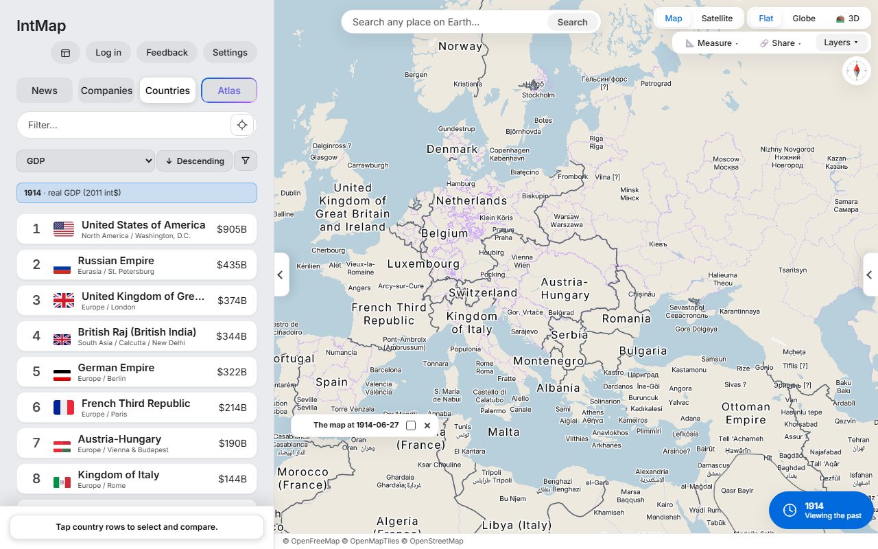
Europe before and after the First World War, 1914–1920
Three dates on one map of Europe: the eve of the war, the armistice, and the map after the peace treaties.
- Europe on 27 June 1914
- Europe on 11 November 1918
- Europe on 1 July 1920
FitsHistory (Rekishi Sōgō) C Changes in the international order, mass society and us
Start the tour →
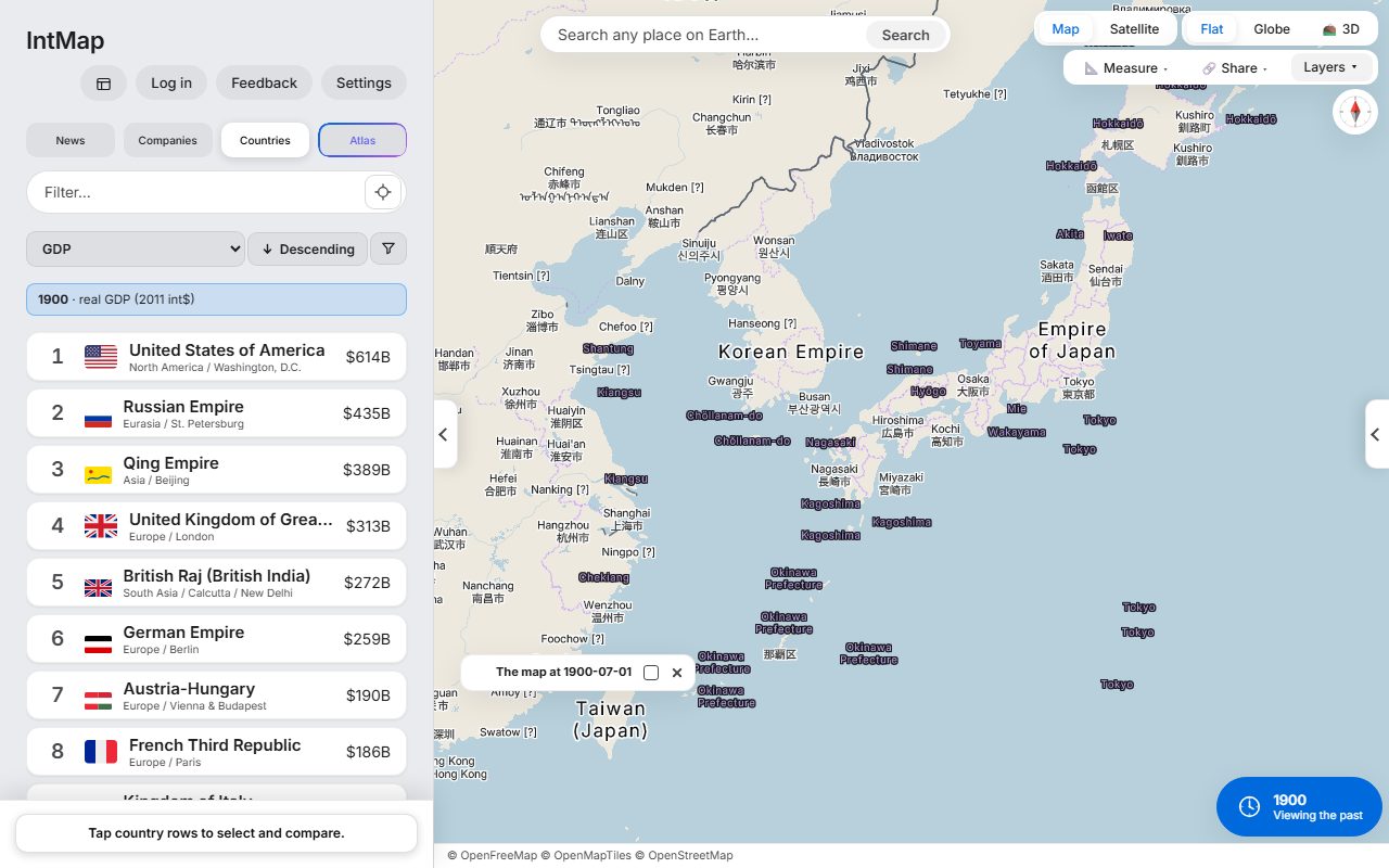
The opening of China and Japan, 1853–1900
East Asia on the day Perry arrived, after the treaties of 1858–1860, when Japan opened Korea in 1876, and in 1900.
- East Asia on 8 July 1853
- East Asia on 1 January 1861
- East Asia on 1 March 1876
- Japan in 1900
FitsHistory (Rekishi Sōgō) B Modernisation and us
Start the tour →
Meiji Japan: from provinces to prefectures
How the map of Japan was redrawn in the Meiji era: the old provinces in 1868, the years after the domains were abolished, and the prefectures of 1900.
- Japan in November 1868
- Japan in July 1872
- Japan in 1900
FitsHistory (Rekishi Sōgō) B Modernisation and us
Start the tour →
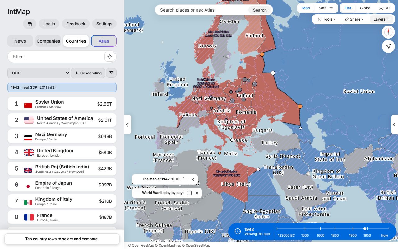
The Second World War, 1939–1945
Seven views on a layer that colours each state by the side that held it: the first days of the war in Europe, the fall of France, Pearl Harbor, the furthest reach of the Axis and of Japan’s conquests, D-Day, and the surrender.
- Europe on 3 September 1939
- Europe on 1 July 1940
- East Asia and the Pacific on 8 December 1941
- The Second World War, 1 November 1942
- East Asia and the Pacific on 1 November 1942
- Europe on 6 June 1944
- The world on 2 September 1945
FitsHistory (Rekishi Sōgō) C Changes in the international order, mass society and us
Start the tour →
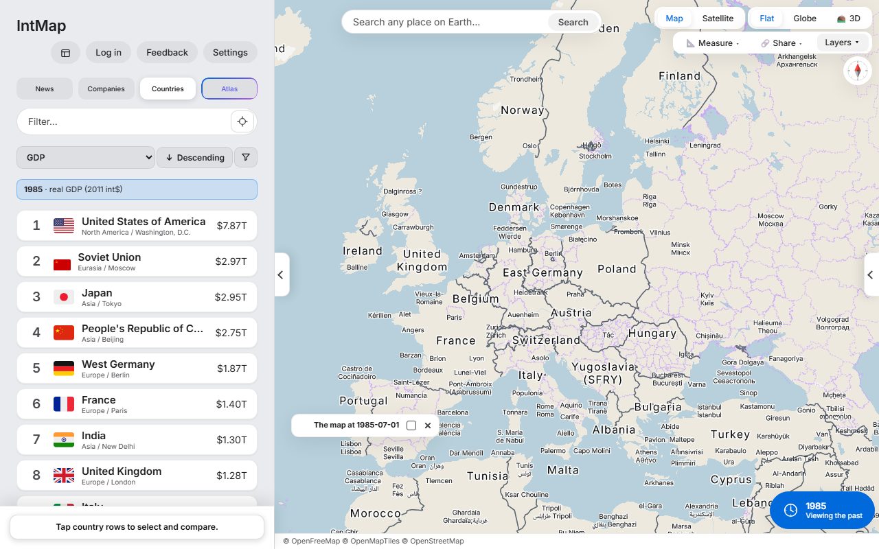
The end of the Cold War in Europe, 1985–1993
Divided Germany in 1985, Germany reunited in 1990, and the map of 1993 after the Soviet Union, Yugoslavia and Czechoslovakia had broken apart.
- Cold War Europe, 1985
- Europe on 3 October 1990
- Europe and the former Soviet Union on 1 January 1993
FitsHistory (Rekishi Sōgō) D Globalisation and us
Start the tour →
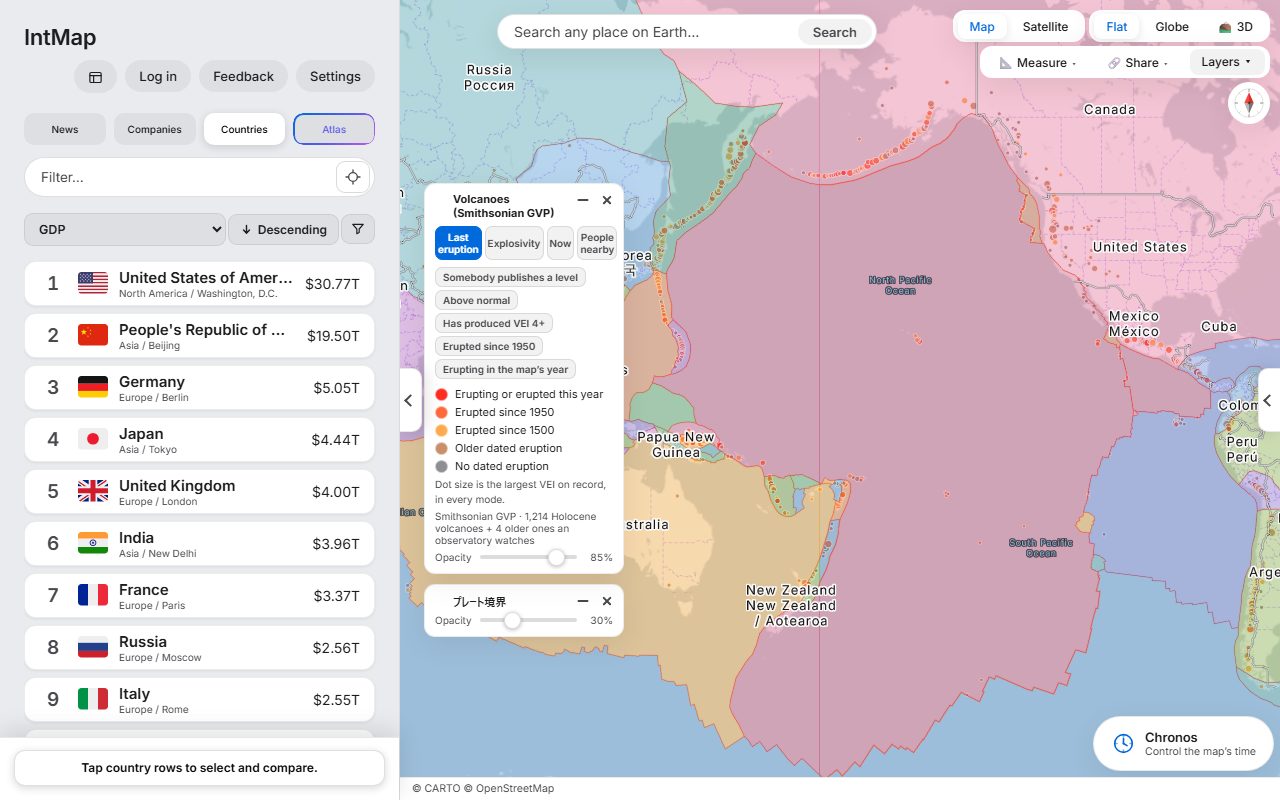
Plates, volcanoes and earthquakes
Where the Earth’s plates meet, and what happens there: the Pacific rim, Japan and Iceland.
- The plate boundaries
- Volcanoes and plate boundaries
- Around Japan
- Iceland
FitsGeography (Chiri Sōgō) C (1) The natural environment and disaster prevention
Start the tour →
Move with the arrow keys, Space or a presentation clicker (Page Up / Page Down); F switches to full screen, T hides the text, Esc leaves the tour. The address bar always holds a link to the step on screen, so you can hand that one step to the students. The printer button on the tour’s panel turns the tour into a worksheet: each step’s map with its legend and data credits, the date it shows, the question and lines to answer on, and a teacher’s copy with what to read out. Print it or save it as a PDF. No account is needed.
Make a tour of your own
The tours above are ours. The tour builder is for the lesson you teach: you set the map up, add it as a step, write what to say, and the whole tour becomes one link. No account is needed, and nothing is stored on a server.
Open the tour builder
In the map, open Settings, then “About & support”, then “Classroom tours”, and choose “Make your own tour”. Atlas can open it too, if you ask for it in words.
Add the map as a step
Set up the place, date, layers and comparison for your first step and press “Add this map as a step”. A step is the map exactly as it was when you added it, the same thing the Share button records.
Write what to say
Give each step a title, the words to read out and, if you like, a question for the class. You can move steps up and down, replace a step’s map, delete a step, and preview the tour from any step.
Hand out the link
Copy the link, or use Share on a device that offers it. Anyone who opens it gets your tour in the same classroom mode as the tours above.
The tour is its link
Your tour is written into the link itself, so there is nothing to upload and no account to give students. The link has a length the site can serve, and the builder shows how much of it your tour uses and warns before a step would not fit; it does not hand out a link the site would refuse.
Your draft stays in your browser
While you write, the draft is kept in this browser, so a reload does not lose it. It is not sent anywhere until you share the link. When you open a tour that someone shared, “Edit this tour” opens it in the builder.
In a lesson
Put the link on the classroom screen or in your class materials. Students move through it with Next and Previous on their own devices, and the address bar always holds a link to the step on screen. To change the tour, edit it and share the new link; links already handed out keep showing the tour they were made from.
The same questions for the whole class
Learn quests ask questions made from the map’s own data, and students answer them on the map: “Find the place” names a city and they tap where it is; “Guess the year” shows a day in history with the year hidden and they answer the year. Each answer is shown on the map.
Play a set
In the map, open the quiz (Layers, then Tools, then Learn quests — or the quiz menu) and choose a quest. A set is five or ten questions and climbs from easy to hard.
Copy the challenge link
At the end of the set, copy the challenge link. It holds which quest it is, a seed and the number of questions — nothing about you and nothing about the answers.
Everyone gets the same questions
Every student who opens the link answers exactly the same questions in the same order, on their own device, so the class can compare scores and talk about the same places and years.
No account is needed, and nothing is sent anywhere: the scores stay on each device (the best score is kept in that browser). The questions come from the map’s data — GeoNames for the cities, the border record and IntMap’s war record for the days — and a rebuilt dataset can change the questions a link gives.
Examples for class
Europe on 27 June 1914
The day before the shots in Sarajevo: Austria-Hungary, Serbia, Montenegro and the Ottoman Empire, with the borders CShapes 2.0 records for that day.
Question for classWhich of these states had disappeared six years later? Open “Europe on 1 July 1920” and compare.
FitsHistory (Rekishi Sōgō) C Changes in the international order, mass society and us
Open this map →
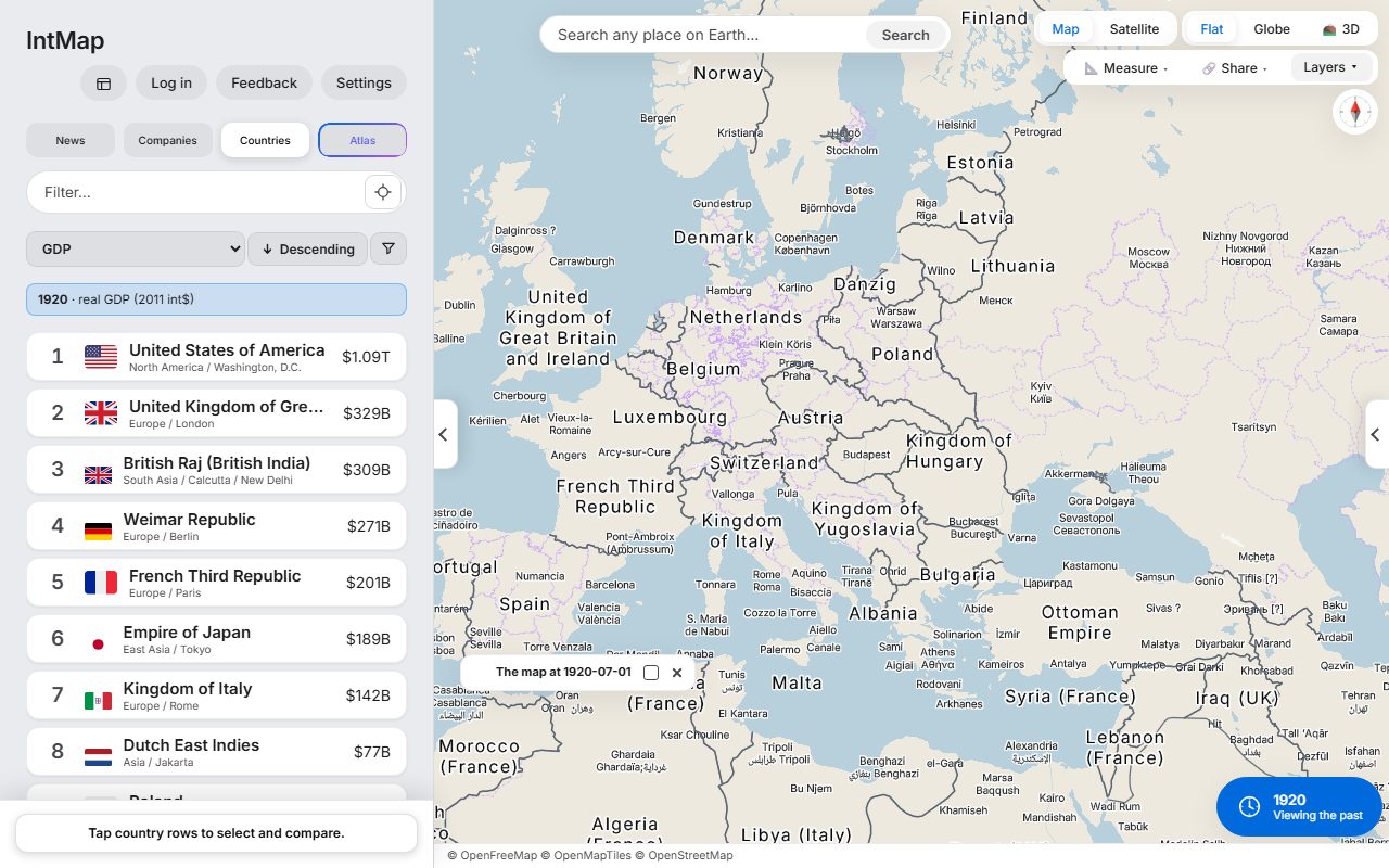
Europe on 1 July 1920
After the First World War: Poland, Czechoslovakia, Finland, Estonia, Latvia and Lithuania are on the map, and Austria and Hungary are two countries.
Question for classThe new states were made from land that had belonged to which empires in 1914?
FitsHistory (Rekishi Sōgō) C Changes in the international order, mass society and us
Open this map →
The Second World War, 1 November 1942
Who held which territory on that day, Axis or Allied, from the war record IntMap carries.
Question for classFind Stalingrad and El Alamein on this map. How far from Germany and Italy had the Axis reached?
FitsHistory (Rekishi Sōgō) C Changes in the international order, mass society and us
Open this map →
Cold War Europe, 1985
West Germany and East Germany side by side, with Czechoslovakia, Yugoslavia and the Soviet Union, on the borders CShapes 2.0 records for that day.
Question for classWhich of the countries on this map no longer exist? What took their place, and when?
FitsHistory (Rekishi Sōgō) D Globalisation and us
Open this map →
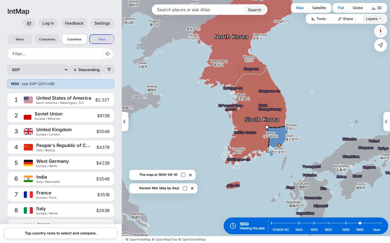
The Korean War, 10 September 1950
Eleven weeks into the war, from the war record IntMap carries: who held which part of the peninsula on that day.
Question for classFive days later came the landing at Incheon. Find Incheon on the map — why might a landing there change the war?
FitsHistory (Rekishi Sōgō) D Globalisation and us
Open this map →
Japan in 1900
Japan divided into prefectures, not the old provinces: the domains were abolished in 1871. Taiwan is under Japanese rule, and Korea is the Korean Empire.
Question for classWhich territories outside today’s Japan were ruled from Tokyo in 1900, and when did that end?
FitsHistory (Rekishi Sōgō) B Modernisation and us
Open this map →
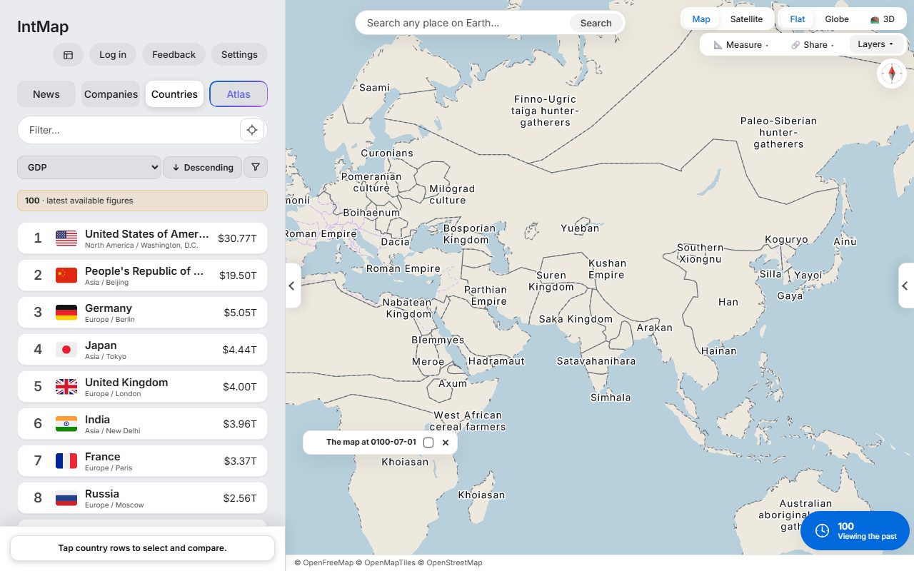
The world in AD 100
The Roman Empire and Han China at the two ends of Eurasia, with the Parthian and Kushan empires between them — the historical-basemaps snapshot for AD 100.
Question for classWhat lay between Rome and Han China, and how might silk have travelled from one to the other?
Open this map →
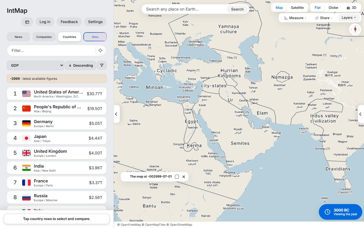
The world in 3000 BC
Egypt, Ur, the Indus valley civilisation and Minoan Crete — the historical-basemaps snapshot for 3000 BC.
Question for classWhich of these early civilisations grew up beside a great river, and why would a river matter?
Open this map →
Volcanoes and plate boundaries
Holocene volcanoes from the Smithsonian Global Volcanism Program, over the plate boundaries of Bird (2003).
Question for classWhy are so many volcanoes found around the edge of the Pacific Ocean?
FitsGeography (Chiri Sōgō) C (1) The natural environment and disaster prevention
Open this map →
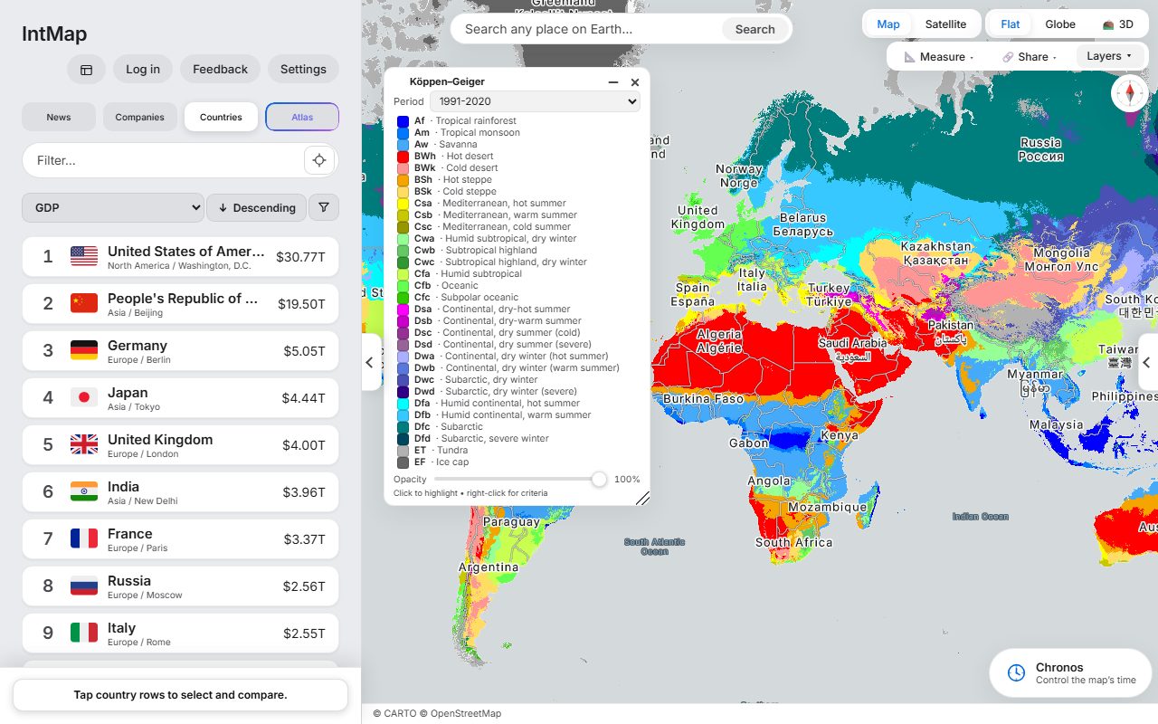
Climates of the world (Köppen–Geiger)
The Köppen–Geiger climate classification of Beck and colleagues, for 1991–2020.
Question for classFind two places at the same latitude with different climates. What makes the difference?
FitsGeography (Chiri Sōgō) B (1) Diversity of ways of life and international understanding
Open this map →
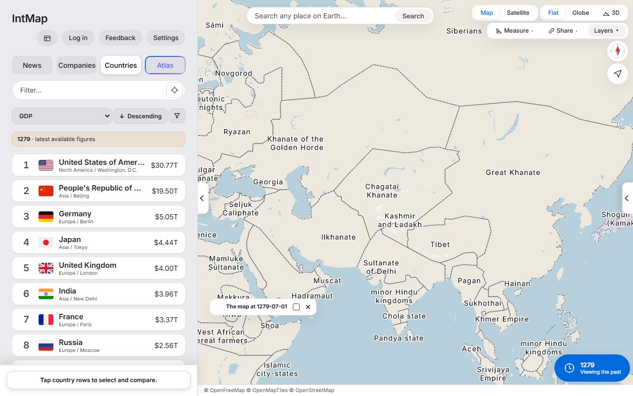
The Mongol world in 1279
The year the last of the Song fell to the Great Khanate. Beside it, the Ilkhanate, the Chagatai Khanate and the Golden Horde: the empire had already split into four. The historical-basemaps snapshot for 1279.
Question for classFind Japan, east of the Great Khanate. Fleets were sent against it in 1274 and 1281 — what did they have to cross?
Open this map →
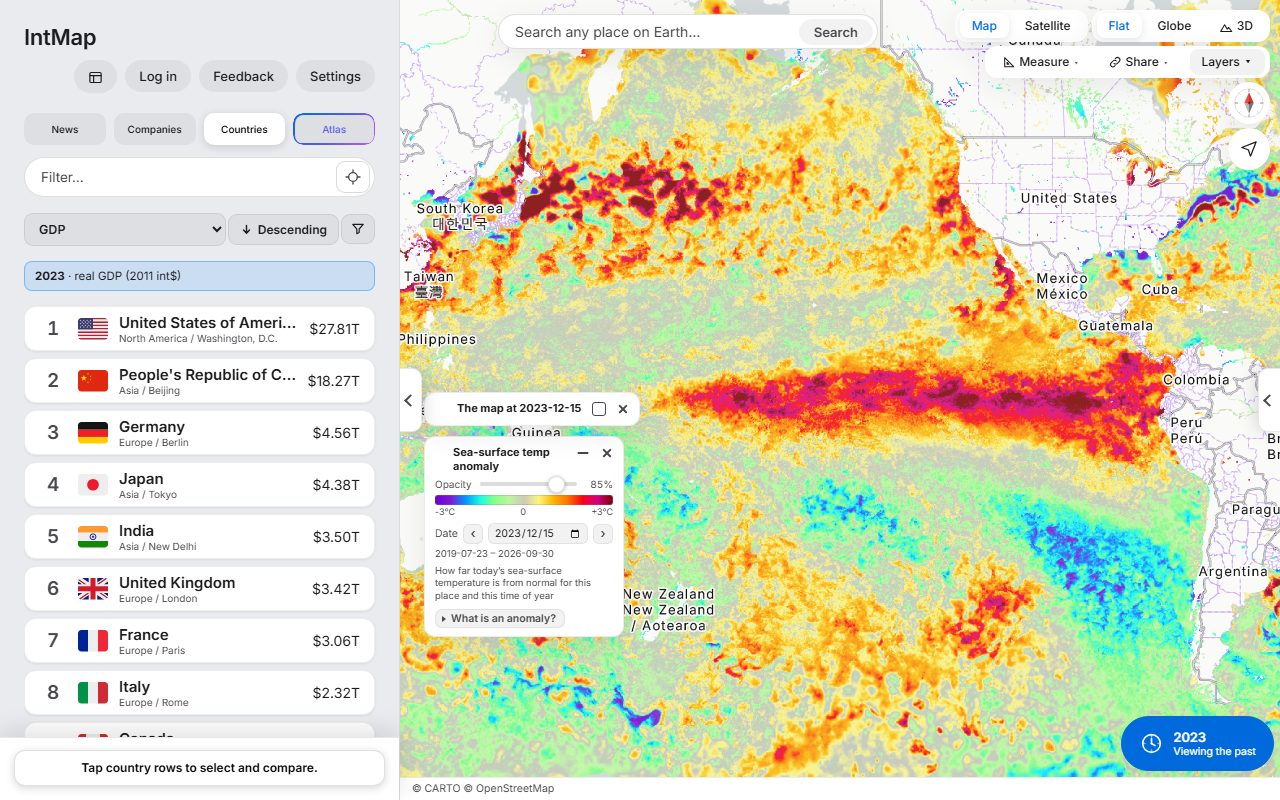
El Niño, 15 December 2023
How much warmer or cooler than usual the sea surface was that day, at the height of the 2023–24 El Niño: the GHRSST MUR anomaly from NASA JPL, through NASA GIBS.
Question for classWhere along the equator is the Pacific warmer than usual? How might that change the rain in Peru and in Indonesia?
FitsGeography (Chiri Sōgō) C (1) The natural environment and disaster prevention
Open this map →
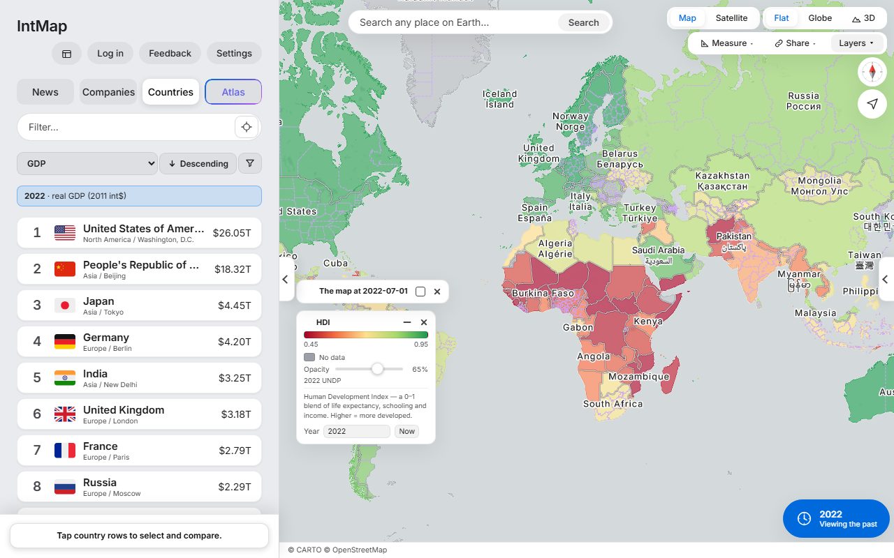
Human development, 2022
Each country coloured by the Human Development Index of the UN Development Programme for 2022 — one number made from life expectancy, years of schooling and income.
Question for classFind two neighbouring countries with very different colours. Which of the three parts — health, schooling or income — might explain the gap?
FitsGeography (Chiri Sōgō) B (1) Diversity of ways of life and international understanding
Open this map →
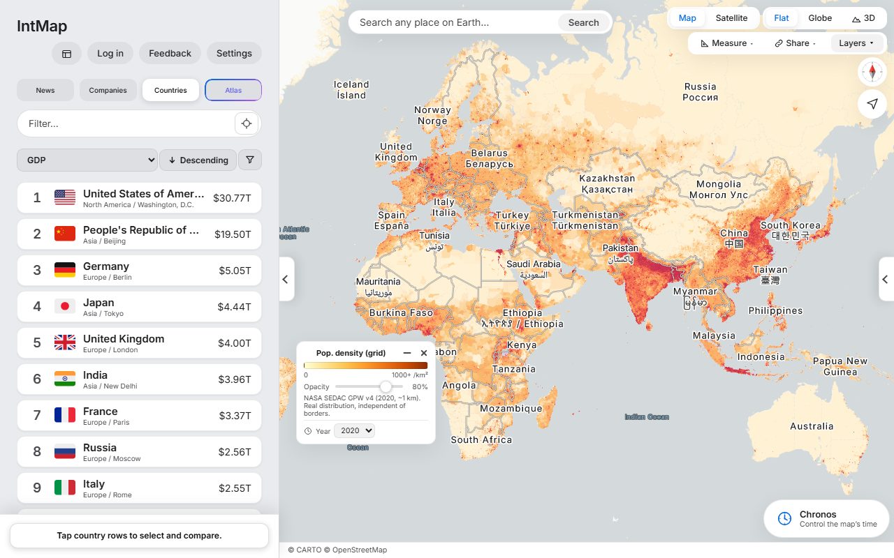
Where people live
Population density from Gridded Population of the World (NASA SEDAC), for 2020.
Question for classWhich large areas have almost nobody living in them? What do they have in common?
FitsGeography (Chiri Sōgō) B (1) Diversity of ways of life and international understanding
Open this map →
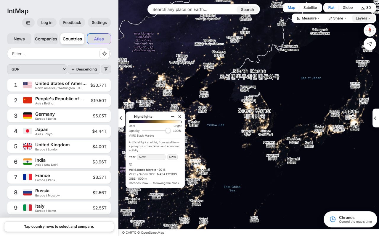
East Asia at night
The lights of cities, roads and ports seen from space: the VIIRS Black Marble composite of 2016 (NASA).
Question for classFind the Korean peninsula. Why is one half so much darker than the other?
FitsGeography (Chiri Sōgō) B (1) Diversity of ways of life and international understanding
Open this map →
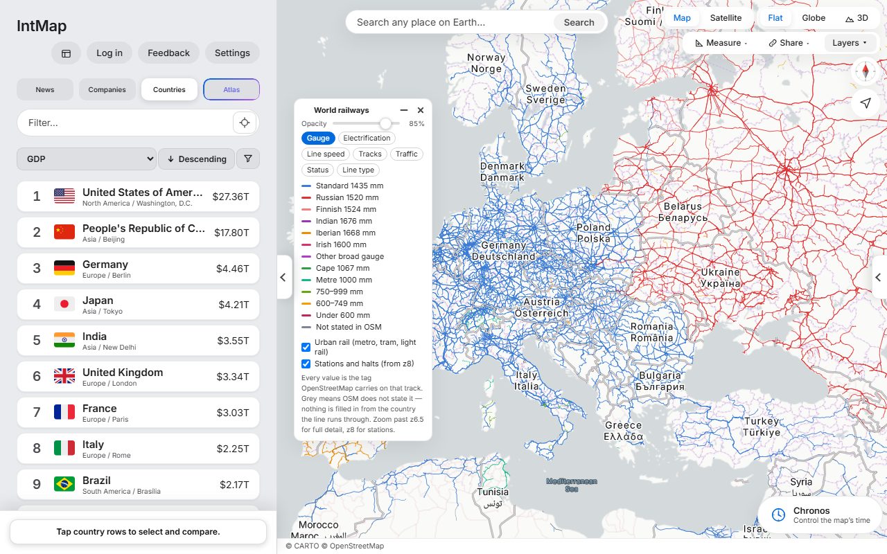
Railway gauges of Europe
Every line coloured by the distance between its rails, as OpenStreetMap records it for that track.
Question for classFind a border where the colour changes. What has to happen to a train that crosses it?
Open this map →
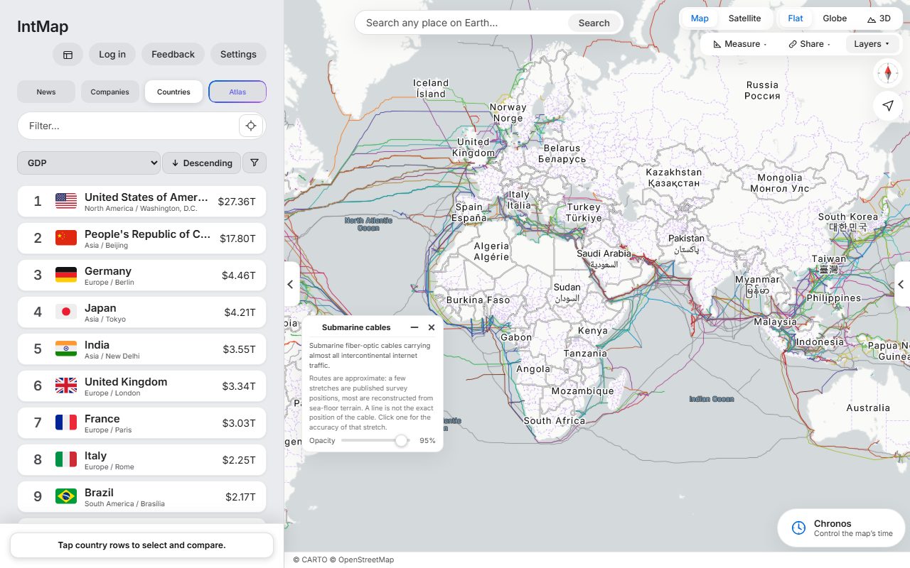
The cables under the sea
The submarine cables that carry the internet between continents: the cables TeleGeography’s Submarine Cable Map lists, on routes reconstructed from the sea floor — a line shows where a cable runs approximately, not exactly.
Question for classWhere do many cables come ashore together? Why might a country want more than one?
FitsGeography (Chiri Sōgō) B (1) Diversity of ways of life and international understanding
Open this map →
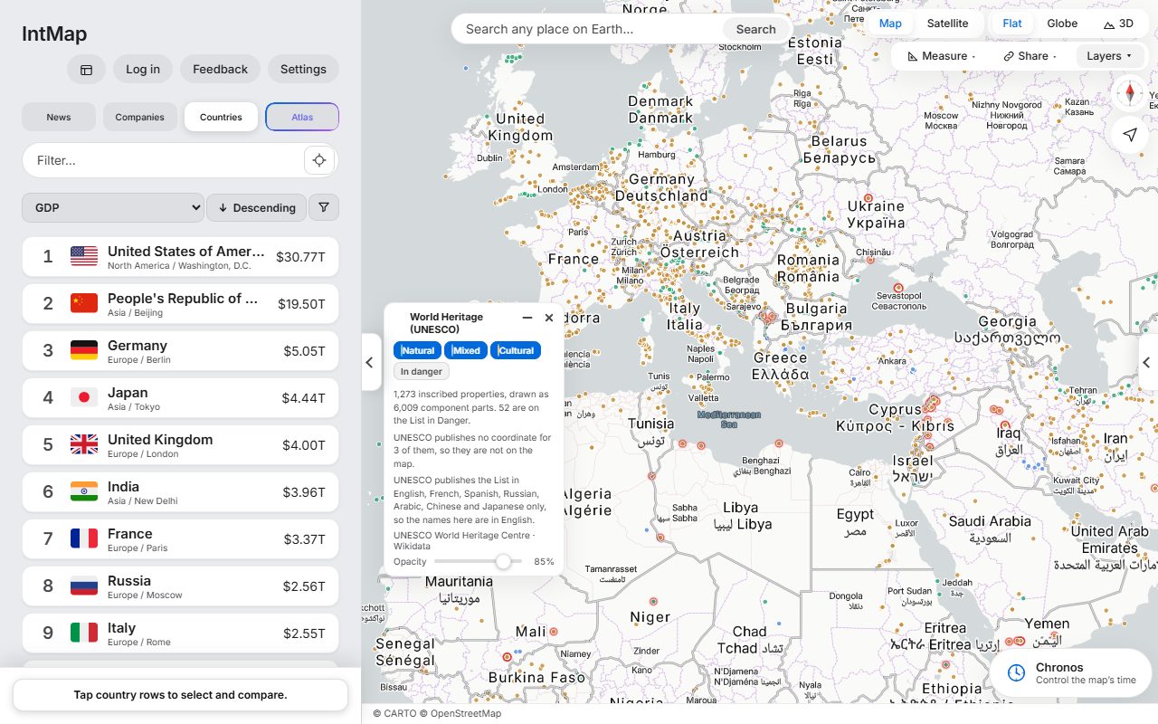
World Heritage sites
Every site on the UNESCO World Heritage List, coloured by whether it is inscribed as cultural, natural or mixed.
Question for classWhere are the natural sites, and where are the cultural ones? Why might they be found in different places?
Open this map →
Where the examples fit Japan’s high-school course
For teachers in Japan: the 2018 Course of Study for upper secondary school made Geography (地理総合) and History (歴史総合) compulsory for every student. The headings below are quoted from it; which example fits which heading is IntMap’s own suggestion, not an official one.
Source: Ministry of Education, Culture, Sports, Science and Technology, “高等学校学習指導要領(平成30年告示)”, read on 1 October 2026. The Course of Study (PDF, mext.go.jp) ↗
Every unit, three curricula: the unit map
Sources and reliability
Every provider is named
The Data sources page lists every organisation whose data the map shows, with its licence.
Data sources →Past dates are drawn only from what describes them
Set the clock to a date and a layer whose source does not describe that date is not drawn. The map lists what it is leaving out, so students are never shown today’s data under an old date.
Where the borders come from
The records are layered, the more precise first, each drawn only where the ones before it are silent: CShapes 2.0 day by day (1886–2019), OpenHistoricalMap day by day (1689–1885), Cliopatria from the Seshat Global History Databank year by year (from 3,400 BC), and 54 snapshots from the historical-basemaps project, each one a single year — where only a snapshot answers, a border between two snapshots is an approximation. The base map’s coastlines are today’s.
How the numbers are worked out
Every calculation and simulation, with its assumptions, is explained on the Science & logic page.
Science & logic →