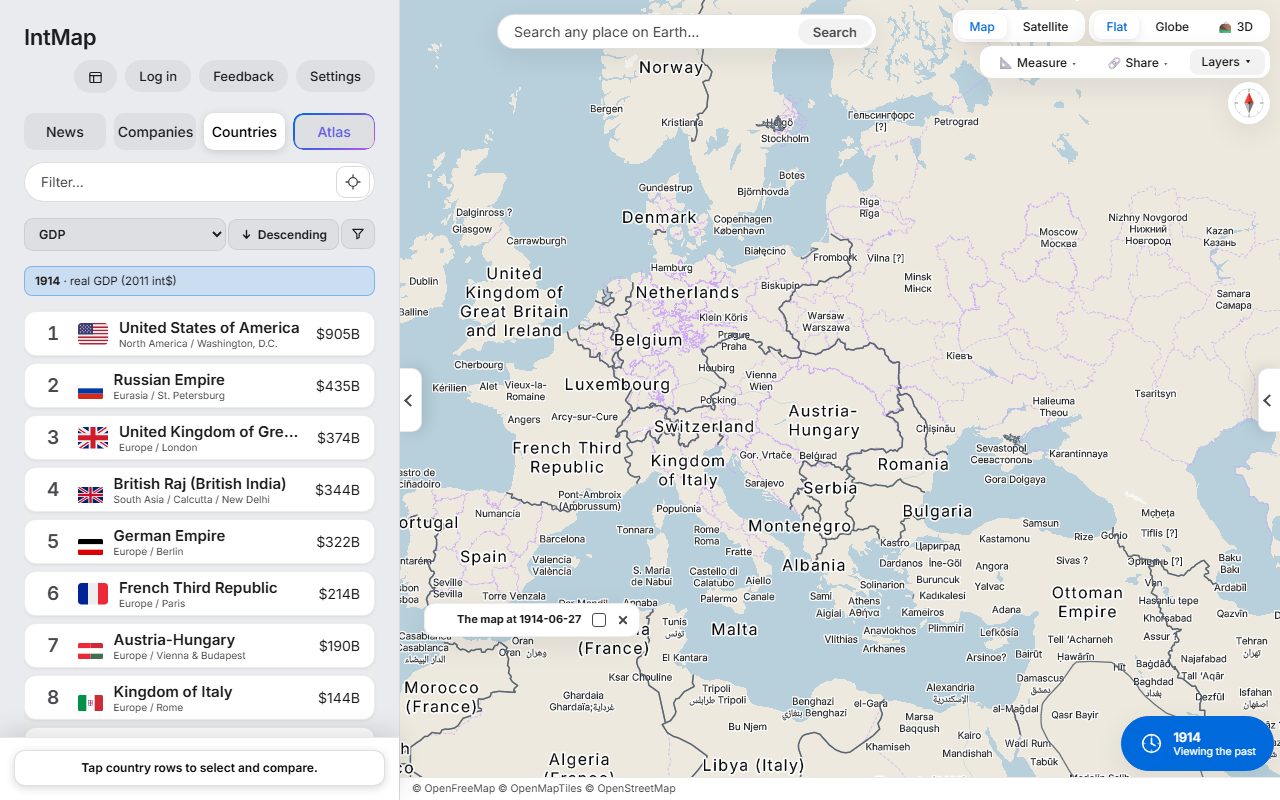
Europe on 27 June 1914
The day before the shots in Sarajevo: Austria-Hungary, Serbia, Montenegro and the Ottoman Empire, with the borders CShapes 2.0 records for that day.
Download (1280×800, 195 kB) → Open this map →Everything for writing about IntMap in one place. The words and the numbers on this page are the same ones the app and the site use, so they stay current.
Quote any of the descriptions below as written. Please keep the numbers as they appear here, and link to IntMap.
A space-time atlas of the Earth
The world today, or in any year, on one map.
Every border is drawn from a named record, and every layer names its source.
A free space-time atlas: the world today, or in any year from 123,000 BC, on one map.
IntMap is a free space-time atlas of the Earth. Today’s map carries live earthquakes, rain radar and aircraft; set the clock to any date from 123,000 BC and the borders, the city names, the provinces and 166 layers follow, each with its source named. It runs in a browser with no sign-up, and one link reopens exactly what you see.
IntMap is a free space-time atlas of the Earth: one map for the world as it is now and as it was on any date. For today it carries live earthquakes, rain radar, aircraft, weather warnings and the news placed where it happened. Move the clock anywhere from 123,000 BC and the map moves with it: country borders day by day from CShapes 2.0 (1886–2019) and OpenHistoricalMap (1689–1885), year by year from Cliopatria (Seshat Global History Databank, from 3,400 BC) where those are silent, and from 54 historical snapshots where none of them speaks. Where the records reach, city labels take that year’s names and the provinces are drawn as they were, and both World Wars can be followed day by day. On the same map sit 166 layers — climate, hazards, population, economy, infrastructure and live feeds — and every one names its source; a layer whose source does not describe the chosen date is simply not drawn. A link reopens the same place, date and layers on any device, and the page for teachers shows how to build a lesson on that. Signed in, Atlas, IntMap’s AI assistant, answers on the map itself. IntMap has no ads and no paid plan and is kept running by donations.
People who want to see where and when things happen and happened — history and geography learners and teachers, map lovers, and anyone following the news.
IntMap is a free space-time atlas of the Earth: one map for the world as it is now and as it was on any date.
For today, the map carries live feeds — earthquakes, rain radar, aircraft, weather warnings. Set the clock to any date from 123,000 BC and the borders, the city names, the provinces and every layer follow, each drawn only from a record that describes that date, with its source named. It opens in a browser, with nothing to install and no account.
Unlike live maps, which know only today, and printed or static historical maps, which show the moments someone chose for you, IntMap puts the present and every past date on one clock; unlike GIS tools, it brings the data with it.
The numbers are read from the app when this page is built. Each layer and each border source is named, with its licence, on the data sources page.
Clock reaches back to
Historical border snapshots
Data layers
Interface languages
Use the mark as it is: do not change its colours or proportions. The name is written IntMap, with no space, and is not translated. The assistant is called Atlas.
Each picture is a real screen of the app at the date and layers named, not a mock-up; the link opens that exact view. The maps carry the credits of the sources they draw — keep the credit line in the picture, and check the licence of each layer on the data sources page before printing.
The day before the shots in Sarajevo: Austria-Hungary, Serbia, Montenegro and the Ottoman Empire, with the borders CShapes 2.0 records for that day.
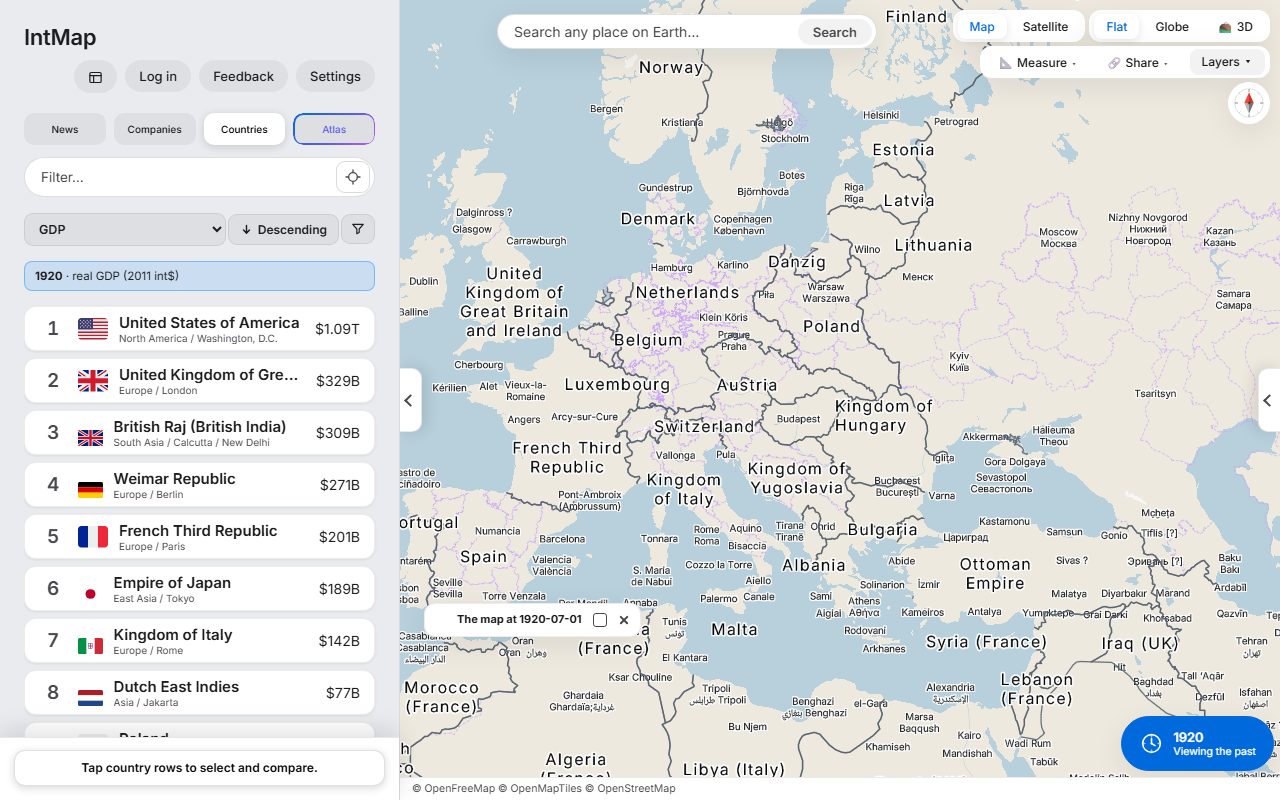
Download (1280×800, 195 kB) → Open this map →After the First World War: Poland, Czechoslovakia, Finland, Estonia, Latvia and Lithuania are on the map, and Austria and Hungary are two countries.
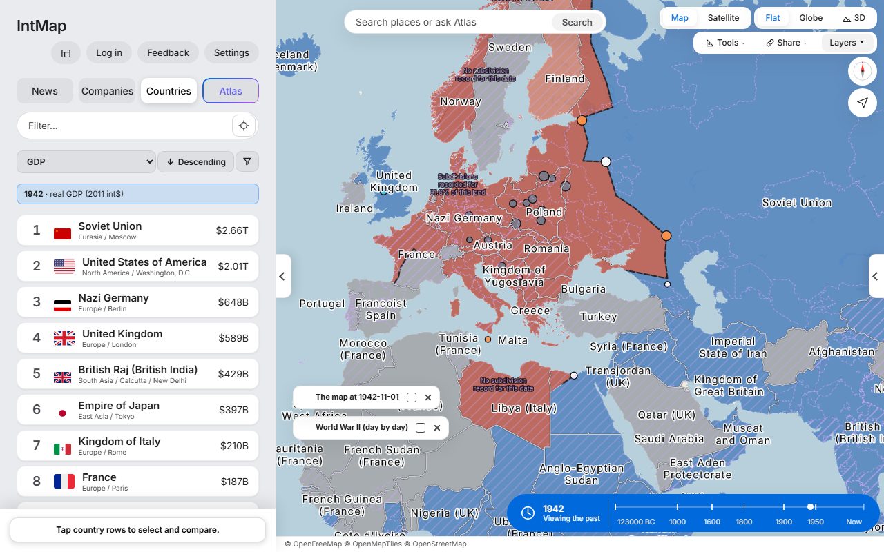
Download (1280×800, 194 kB) → Open this map →Who held which territory on that day, Axis or Allied, from the war record IntMap carries.
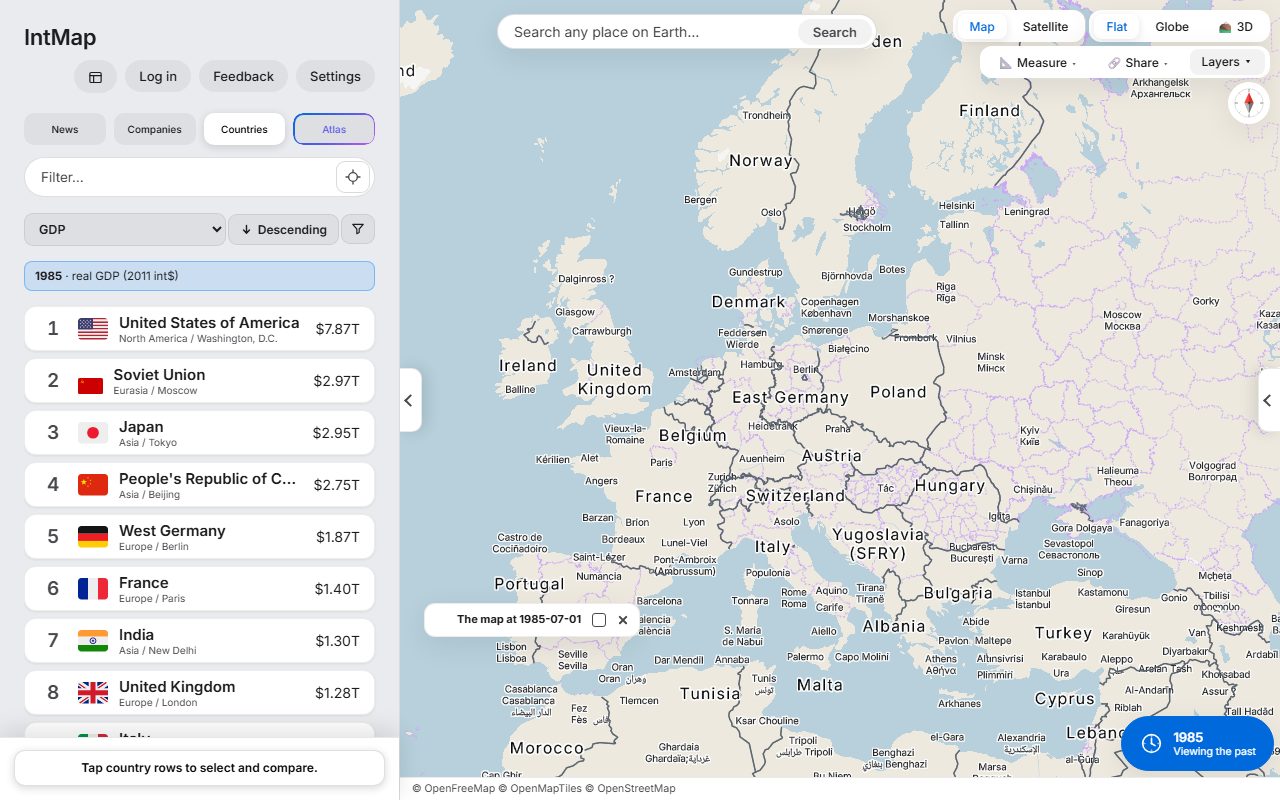
Download (1280×800, 187 kB) → Open this map →West Germany and East Germany side by side, with Czechoslovakia, Yugoslavia and the Soviet Union, on the borders CShapes 2.0 records for that day.
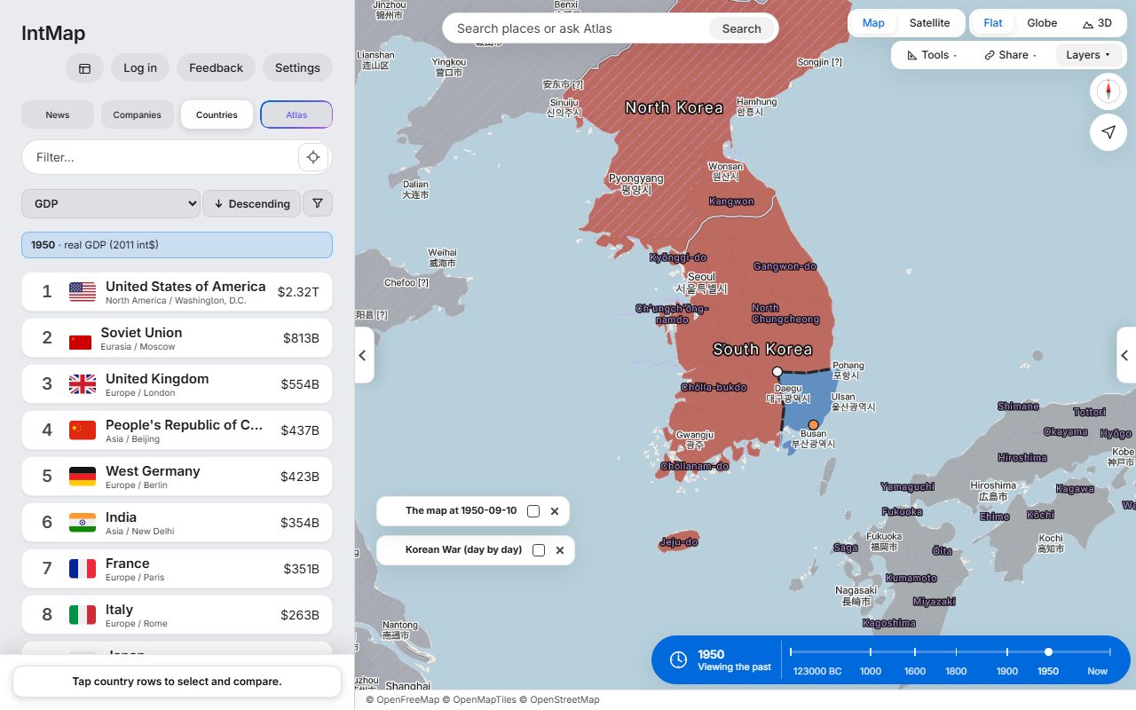
Download (1280×800, 180 kB) → Open this map →Eleven weeks into the war, from the war record IntMap carries: who held which part of the peninsula on that day.
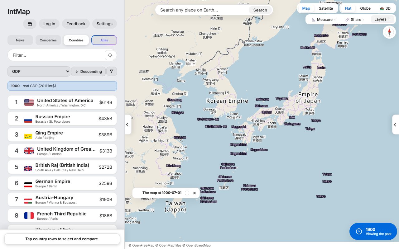
Download (1280×800, 129 kB) → Open this map →Japan divided into prefectures, not the old provinces: the domains were abolished in 1871. Taiwan is under Japanese rule, and Korea is the Korean Empire.
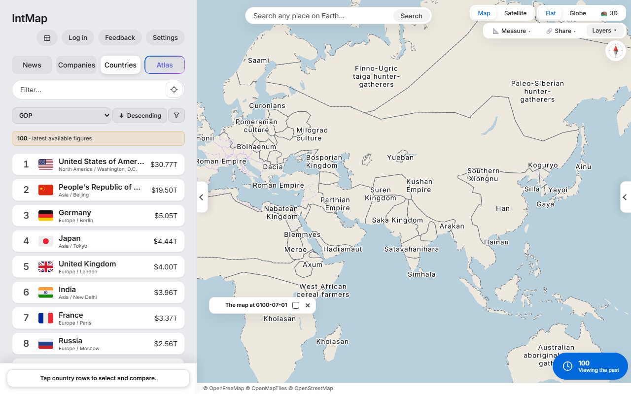
Download (1280×800, 135 kB) → Open this map →The Roman Empire and Han China at the two ends of Eurasia, with the Parthian and Kushan empires between them — the historical-basemaps snapshot for AD 100.
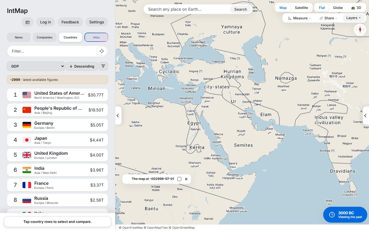
Download (1280×800, 140 kB) → Open this map →Egypt, Ur, the Indus valley civilisation and Minoan Crete — the historical-basemaps snapshot for 3000 BC.
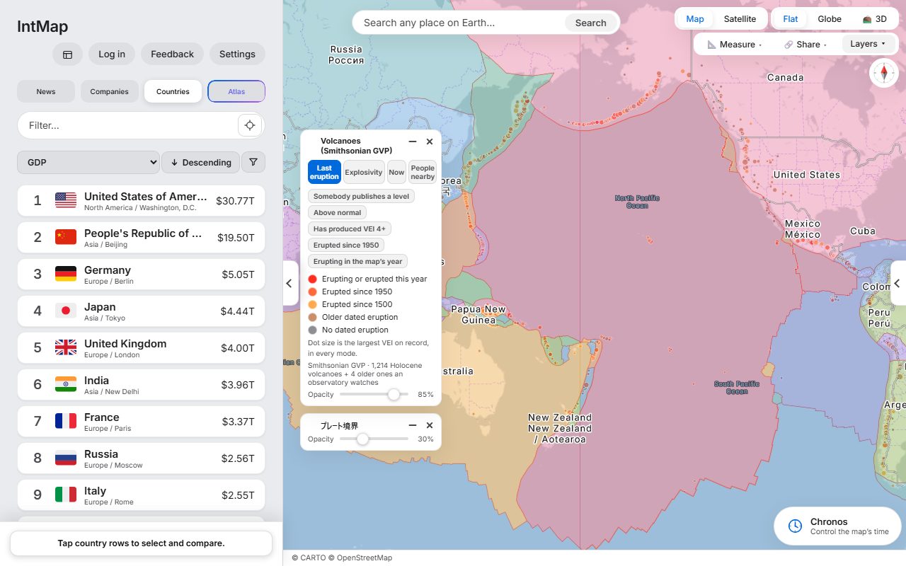
Download (1280×800, 149 kB) → Open this map →Holocene volcanoes from the Smithsonian Global Volcanism Program, over the plate boundaries of Bird (2003).
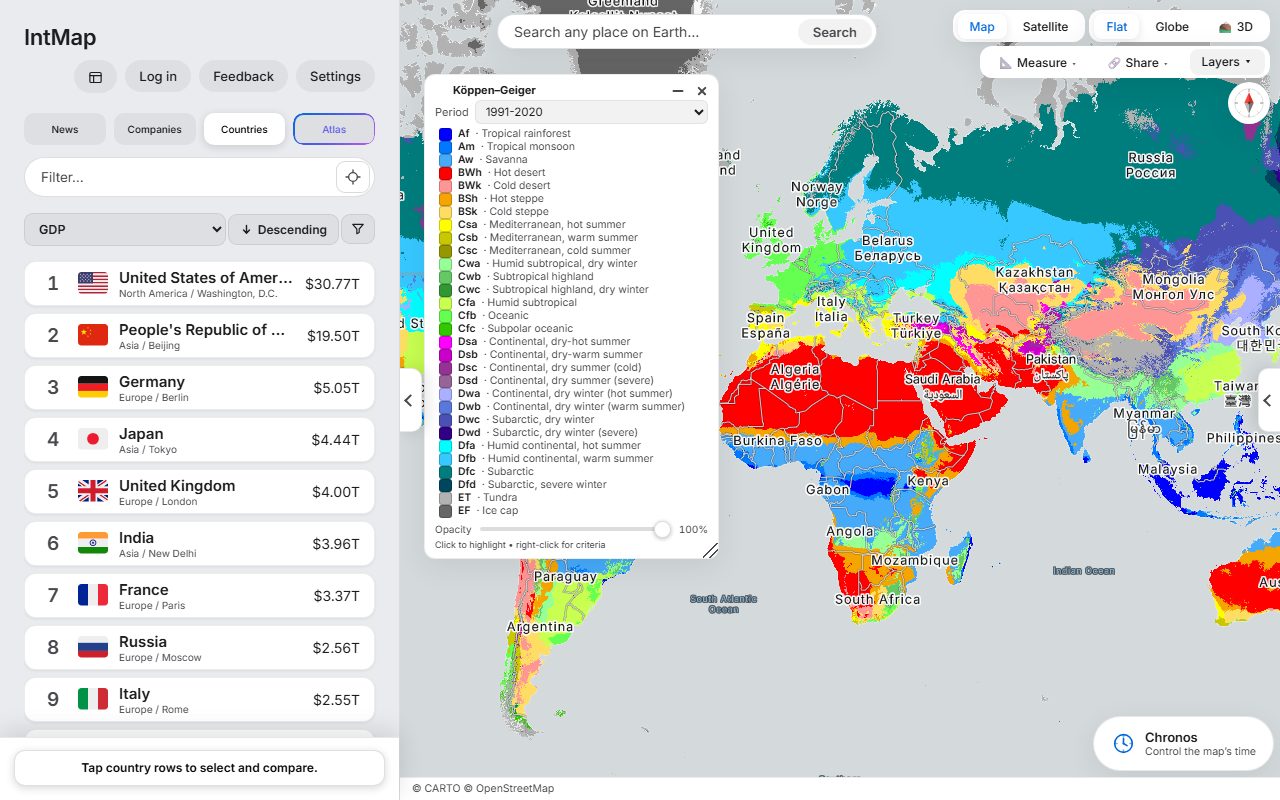
Download (1280×800, 130 kB) → Open this map →The Köppen–Geiger climate classification of Beck and colleagues, for 1991–2020.
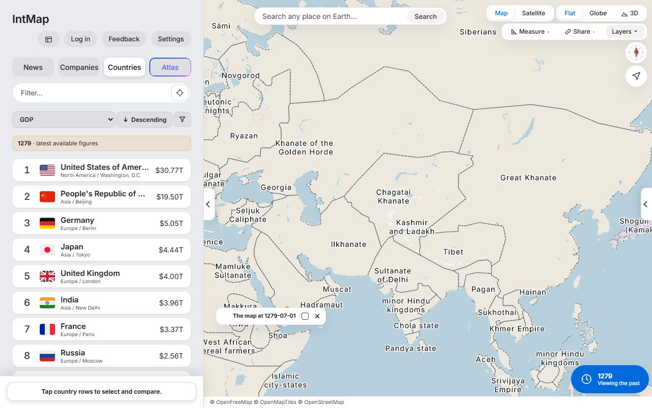
Download (1280×800, 194 kB) → Open this map →The year the last of the Song fell to the Great Khanate. Beside it, the Ilkhanate, the Chagatai Khanate and the Golden Horde: the empire had already split into four. The historical-basemaps snapshot for 1279.
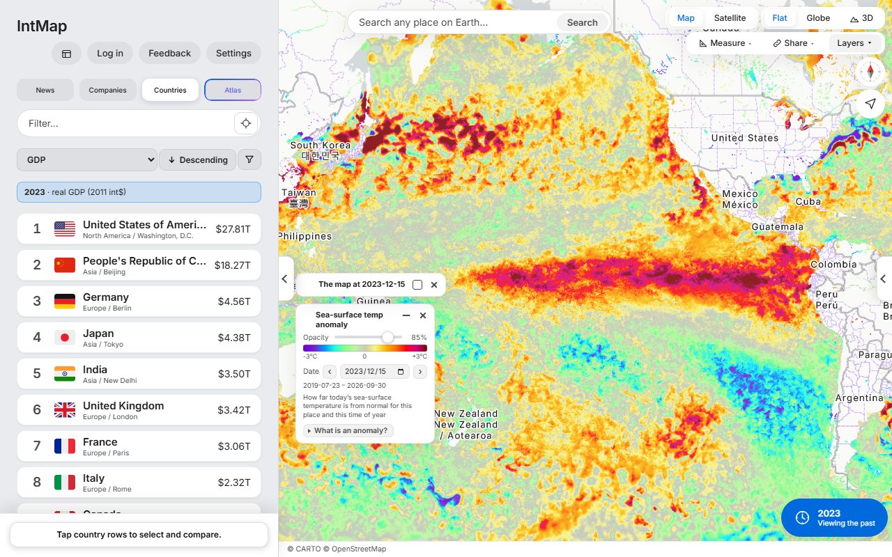
Download (1280×800, 141 kB) → Open this map →How much warmer or cooler than usual the sea surface was that day, at the height of the 2023–24 El Niño: the GHRSST MUR anomaly from NASA JPL, through NASA GIBS.
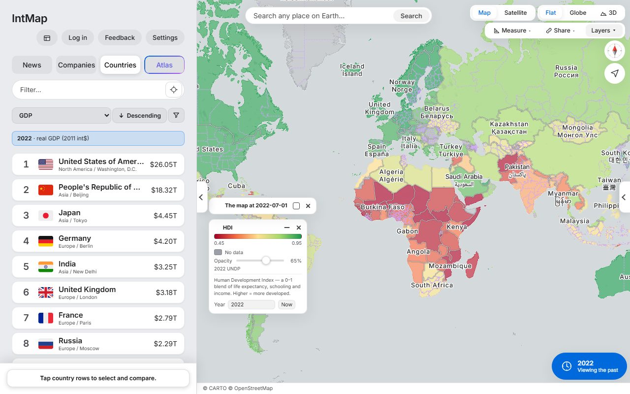
Download (1280×800, 242 kB) → Open this map →Each country coloured by the Human Development Index of the UN Development Programme for 2022 — one number made from life expectancy, years of schooling and income.
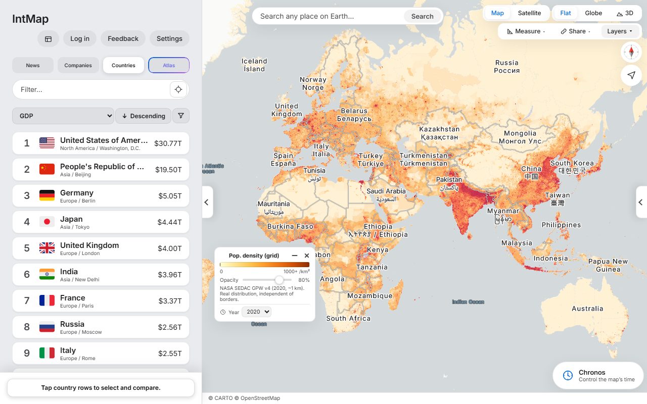
Download (1280×800, 149 kB) → Open this map →Population density from Gridded Population of the World (NASA SEDAC), for 2020.
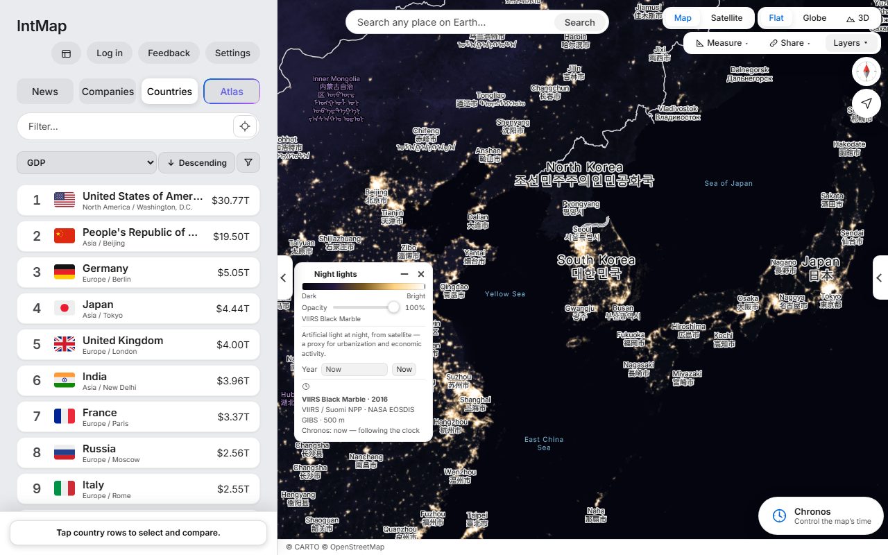
Download (1280×800, 160 kB) → Open this map →The lights of cities, roads and ports seen from space: the VIIRS Black Marble composite of 2016 (NASA).
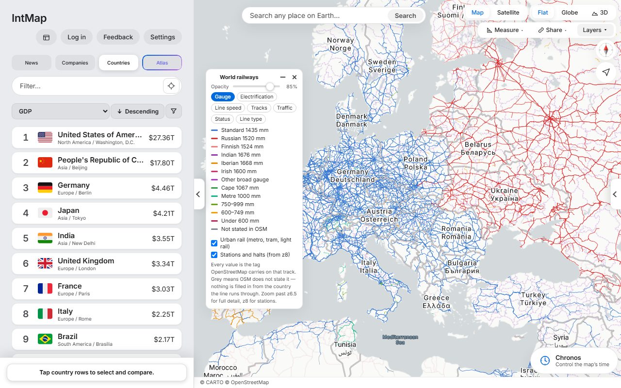
Download (1280×800, 166 kB) → Open this map →Every line coloured by the distance between its rails, as OpenStreetMap records it for that track.
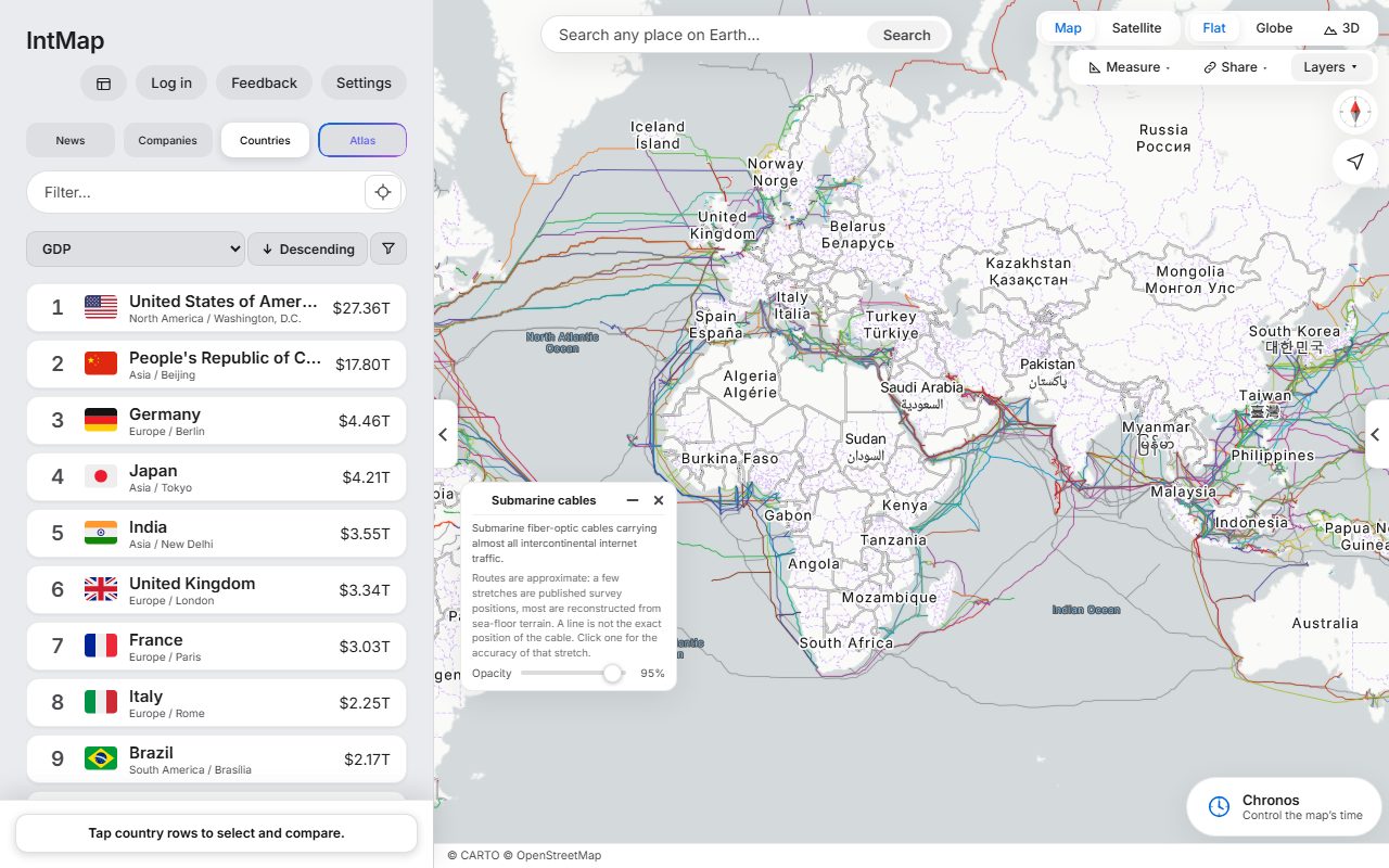
Download (1280×800, 246 kB) → Open this map →The submarine cables that carry the internet between continents: the cables TeleGeography’s Submarine Cable Map lists, on routes reconstructed from the sea floor — a line shows where a cable runs approximately, not exactly.
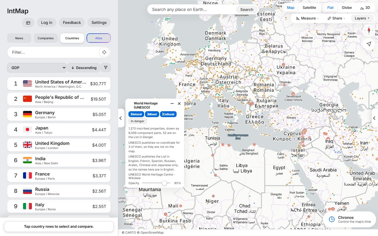
Download (1280×800, 181 kB) → Open this map →Every site on the UNESCO World Heritage List, coloured by whether it is inscribed as cultural, natural or mixed.
Download (1280×800, 212 kB) → Open this map →A view of IntMap can be embedded in an article, with its credits in the frame.
For newsrooms →