The world in 123,000 BC
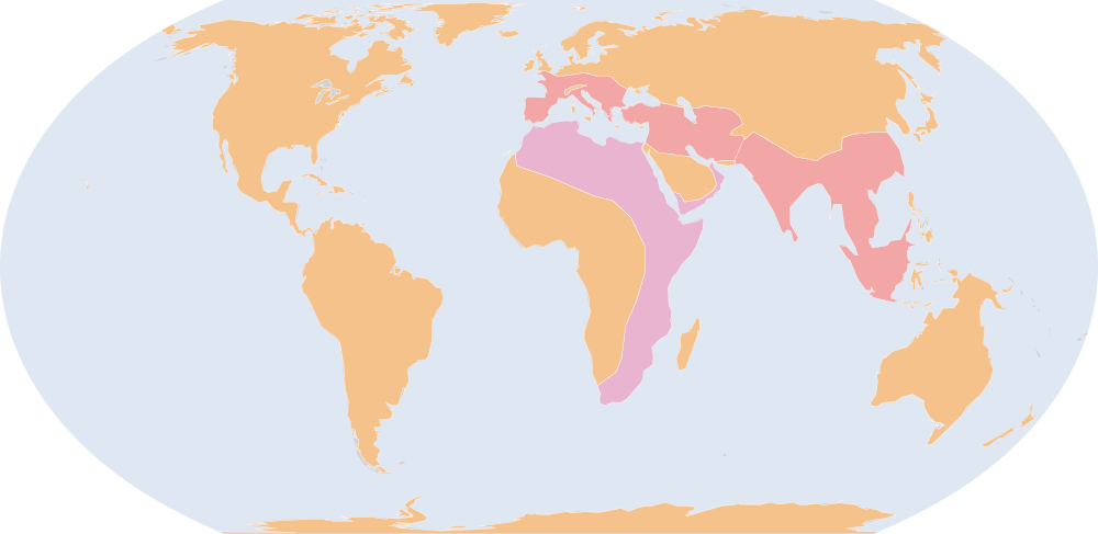
On 1 July 123,000 BC, IntMap’s historical map draws 3 names across the world. The borders for this date come from historical-basemaps — each drawn only where the records before it are silent. It also draws 153 outlines whose name the record does not give for this date.
Why this year has a page
The historical-basemaps atlas drew a world sheet for this year.
Names on the map
As the map labels them, largest first by the area of the outline drawn. Areas are of the drawn outline, rounded, and approximate. The record column says which record draws the outline; a Wikidata item is given where the record links one.
| Name | Record | Drawn area (km²) |
|---|---|---|
| Homo heidelbergensis | historical-basemaps | 15,900,000 |
| Homo erectus | historical-basemaps | 12,200,000 |
| Neanderthal | historical-basemaps | 7,370,000 |
This is the earliest year with a page.
Events dated to 123,000 BC
The index of dated events holds no event for 123,000 BC.
Sources and method
Borders and names: aourednik/historical-basemaps (github.com/aourednik/historical-basemaps) · GPL-3.0 · adapted by IntMap: each sheet before 1886 less the ground OpenHistoricalMap and Cliopatria state at that sheet's year.
Which years have a page is worked out when the site is built, from three rules applied to the records themselves: every year the historical-basemaps atlas drew a world sheet for; every year whose change from the year before (names the dated records begin or stop drawing) is in the top 5% of all such year-to-year changes since the dated records begin, leaving out the years where one record hands over to another; and every year of a geopolitical, war or revolution event in the dated events index, up to the last year the border records cover (2019).
On each year the map is read on 1 July, the instant the app’s own year links open on. Names are the source’s own, translated where the source or IntMap’s name table has a translation. A name is what a record draws there, not a verdict of history.
World map in 123,000 BC — the map, with the years it stays the same Historical maps by region Countries On this day