紀元前10,000年の世界
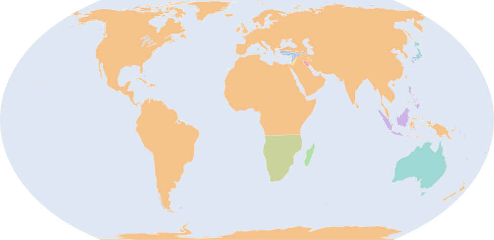
紀元前10,000年7月1日、IntMap の歴史地図は世界に14の名前を描きます。この日付の国境はhistorical-basemaps(各記録は、前の記録が述べていない土地にだけ描く)によります。 このほか、この日付について記録が名前を与えていない輪郭を119描いています。
この年にページがある理由
historical-basemaps の地図帳がこの年の世界図を描いています。
地図に描かれる名前
地図が書く名前で、描かれる輪郭の面積が大きい順に並べています。面積は描かれた輪郭のもので、丸めた概算です。「記録」はその輪郭を描く記録で、記録が Wikidata の項目を結んでいる場合はそれを示します。
| 名前 | 出典の綴り | 記録 | 描かれる面積(km²) |
|---|---|---|---|
| 先住民の諸部族 (出典による説明で、名前ではない) | Aboriginal tribes | historical-basemaps | 7,600,000 |
| Khoisan | historical-basemaps | 6,360,000 | |
| Austronesians | historical-basemaps | 1,510,000 | |
| Hunters-gatherers | historical-basemaps | 602,000 | |
| Steppe Mesolithic Hunter-Foragers | historical-basemaps | 295,000 | |
| Coastal and Woodland Mesolithic Hunter-Foragers | historical-basemaps | 218,000 | |
| オホーツク文化 | Okhotsk culture | historical-basemaps | 186,000 |
| Jōmon | historical-basemaps | 174,000 | |
| Alluvial Lowland Mesolithic Hunter-Foragers | historical-basemaps | 117,000 | |
| Levantine Corridor (Neolithic Farmers) | historical-basemaps | 80,500 | |
| タスマニア・アボリジニ | Aboriginal Tasmanians | historical-basemaps | 59,400 |
| HIghland Mesolithic Hunter-Foragers | historical-basemaps | 43,400 | |
| Neolithic Farmers | historical-basemaps | 21,900 | |
| Highland Mesolithic Hunter-Foragers | historical-basemaps | 19,100 |
紀元前123,000年からの変化
数えるのは、年または日の単位で日付を持つ記録(CShapes・OpenHistoricalMap・Cliopatria)の名前です。最も近い historical-basemaps の図から補った輪郭は、両方の年がその図の描かれた年であるときだけ数えます——そうでなければ、変化は2枚の図の切り替わりであって世界の変化ではないからです。名前は書かれたとおりに比べるので、記録が2つの年で別の名前で書く政体(Carthaginian Empire と Carthage など)は両方の欄に出ます。
新たに描かれる(14)
先住民の諸部族、Khoisan、Austronesians、Hunters-gatherers、Steppe Mesolithic Hunter-Foragers、Coastal and Woodland Mesolithic Hunter-Foragers、オホーツク文化、Jōmon、Alluvial Lowland Mesolithic Hunter-Foragers、Levantine Corridor (Neolithic Farmers)、タスマニア・アボリジニ、HIghland Mesolithic Hunter-Foragers、Neolithic Farmers、Highland Mesolithic Hunter-Foragers
描かれなくなった(3)
Homo heidelbergensis、Homo erectus、Neanderthal
紀元前10,000年の出来事
日付つき出来事の索引には、紀元前10,000年の出来事がありません。
出典と方法
国境と名前:aourednik/historical-basemaps (github.com/aourednik/historical-basemaps) · GPL-3.0 · adapted by IntMap: each sheet before 1886 less the ground OpenHistoricalMap and Cliopatria state at that sheet's year。
どの年にページがあるかは、サイトのビルド時に記録そのものに3つの規則を当てて決めています:historical-basemaps の地図帳が世界図を描いたすべての年/前年からの変化(日付を持つ記録が描き始める・描かなくなる名前の数)が、日付を持つ記録が始まって以来の年ごとの変化の上位5%に入るすべての年(ある記録から別の記録へ引き継ぐ年は除く)/日付つき出来事の索引にある地政・戦争・革命の出来事のすべての年(国境の記録が覆う最後の年 2019 年まで)。
各年は7月1日で地図を読みます(アプリの年のリンクが開く瞬間)。名前は出典のもので、出典か IntMap の名前表に訳があるときは訳します。名前は記録が描くものであって、何が存在したかの判定ではありません。